
Get your Assets in the Cloud: Utilizing GIS for Asset Management
The urgency of going remote quickly identified gaps in existing systems. Many have been forced to use tools that have always been at their disposal- but often overlooked. GIS has always been an advantageous opportunity for asset management. But, recent events have proven that getting assets into the cloud is absolutely critical, and should be a priority.

GPS Data Capture
So many people rushed out of their facility with urgency- with no idea what the restrictions would be on returning; or, no concept that they’d be gone for quite so long. For some, simple things as lunch boxes were accidentally left behind. For others, plans and documents that help things move forward- are still sitting exactly where they were left.
For years, organizations have identified ways to stop relying so heavily on paper. Overfull filing cabinets, messy desks, and printing costs are all contributors to this goal. But, being forced to work remotely has proven to be the catalyst that many need to, finally, stop relying on paper.
For asset management, in particular, having consistent and constant access to the most up-to-date information is crucial to maintaining operations effectively.
But the need to have asset information accessible is not new. For years, asset management has been a point of contention for many. What is the most efficient, the most effective, the most valuable… the best way to manage assets?
Cloud-based infrastructure through GIS has always been an advantageous opportunity for asset management. But, recent events have proven that getting assets into the cloud through GIS is absolutely critical, and should be a priority.
Here are 5 reasons that GIS is a game-changer for asset management.
1. Always at your fingertips
“Let me look through my files” is a thing of the past. What happens when you’re in an emergency? What happens when your paper files aren’t accessible? When it comes to asset management, the most important and crucial question is, “Can you find it when you need it?”
For many, going digital began long before this. You see- going digital, using the cloud, creating apps to collect data, none of this is unique to GIS. It’s the incorporation of geographic location and maps that changes the game.
You might already store digital photos of all of your assets. Or scan important updates that relate to construction or modifications to the systems you manage. But- what good are those folders and files- if you can’t find what you need when you need it?

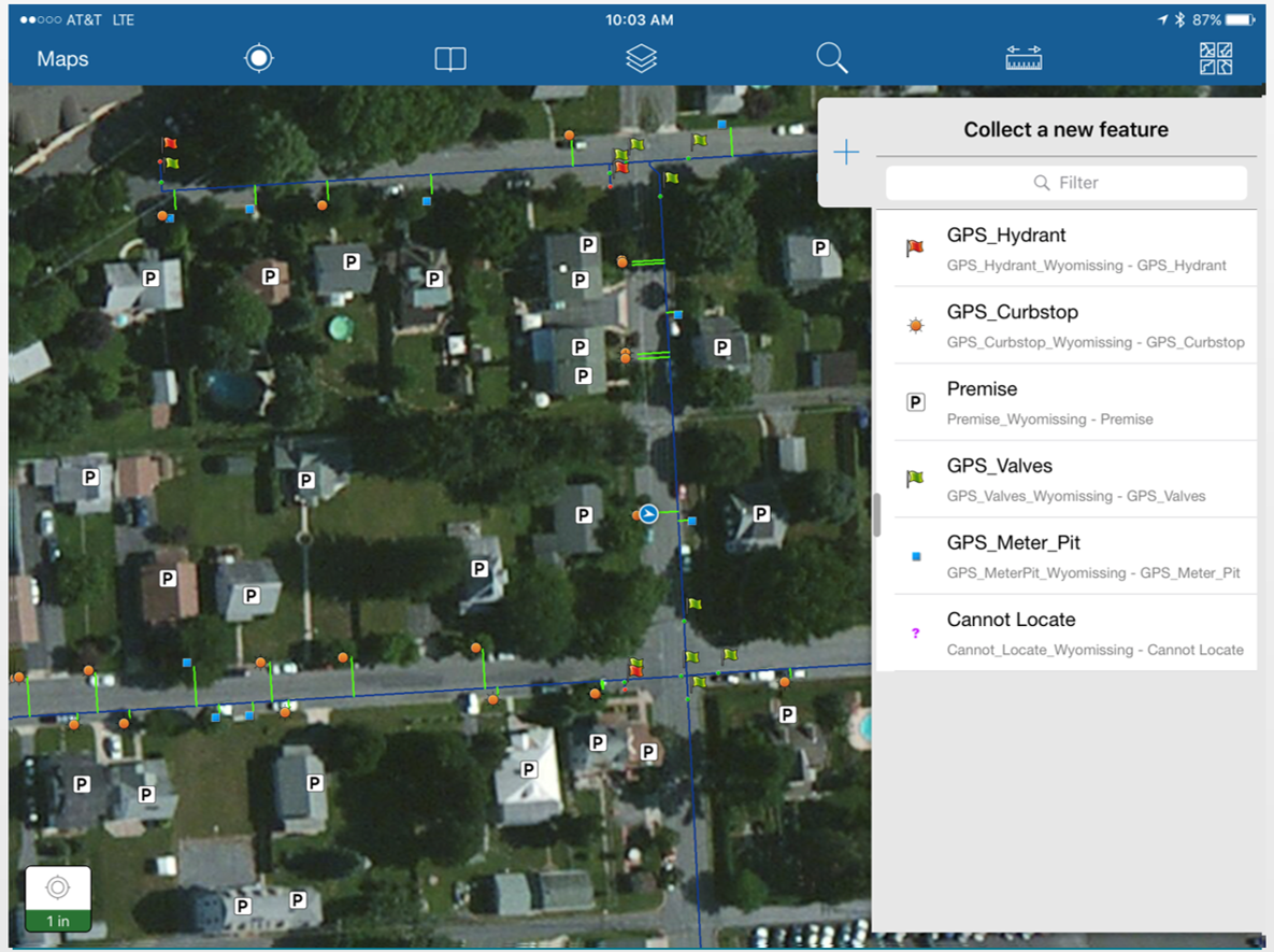
GIS to Document Field Photos
Because in an emergency, you might not just need a picture of any water valve. You need a picture of the exact water valve that resides exactly where your crew is standing.
With GIS, the information you need is always there when you need it. The connection of asset information to location makes asset management easier, and more forward-thinking than ever before.
Here, there, anywhere, your information is accessible. Smart phones, computers, tablets, the digital list is endless. It’s where you need it, when you need it.
Most reports are showing that organizations across the globe have been moved to reconsider what work looks like. This includes remote work becoming a “new normal”. Being forward-thinking means being prepared for the future. Having your assets managed for the future, means having information at your fingertips- no matter where you are or when you need it.
2. Always up to date
One of the most valuable capabilities of GIS is its ability to be constantly updated. Paper plans are only good for the moment in which they are printed. Any changes force plans out of date, and in many cases, out of use.
Consider construction of a utility as a great example. An engineer designs a utility plan. The design plan (paper) gets passed on to construction. During construction, changes are, inevitably, made to the original design plan. These markups are often written on the design plan, forming the basis for the final record “as built” plan.
Sounds like a decent workflow, right? But, what if the design plan wasn’t on paper? What if it was accessed through a tablet? And, during construction, a tablet could be used to make markups. Our GIS team updates the map, and now the plans that you- or anyone- have in their hands at any time are always the right plans, always the most up to date plans, and always they plans they need.
3. Always moving
Let’s think back to the last example- the workflow of passing and updating and editing paper plans. How many projects were put on hold, or at least delayed, because someone, somewhere, had a paper that you couldn’t get to?
This point- GIS keeps things moving- is perhaps one of the key points that organizations learned over the past few months.
When your assets are in the cloud, when you utilize GIS for asset management- projects don’t stop. And emergencies? You’re ready for them too. You shouldn’t be spending time looking through your files, coordinating “get that paper to you” time, or even having to deal with the aftermath of an emergency that was poorly prepared for. Find it, use it, have it- all when you need it.
4. Always together
GIS for asset management also means that everything lives together in one spot. Project notes, locations, pictures, data, it is all embedded together, associated with the geographic point.
What this means is no longer trying to squeeze 3 sentences of notes into the small margin of a paper plan. What this means is no longer having post it notes and scrap paper circulating everywhere. What this means is everything stays together. Everything has a spot. Everything, is where it should be.
Even the simplest maps might have extensive comments that make the map meaningful. Instead of printing and writing- embed a note on a digital map. Now, it’s accessible for many and meaningful to all.
5. Always able to grow
Re-configuring your entire asset management system to GIS sounds intimidating. We get that. But what we love about GIS is its growth opportunity.
We’ve worked with municipalities that only wanted to start small. All they wanted was for field pictures to be accessible in the field. So, instead of taking millions of pictures and storing them in folders on their hard drive- they connected these to a GIS map. So when a field crew arrives to repair an underground utility, they can look at a photo of the installation and understand the configuration before digging it up.
Just pictures. Pictures attached to location create valuable information. Just pictures then expands to more- description of the project, notes about issues or concerns, maintenance records. It’s a simple start of implementation, with the power to grow into a hugely dynamic resource.
We’ve also worked with utility teams that go much bigger- digitizing records for every pipe, valve, and hydrant, everything they own including scans of hand-written plans.

GIS as a Record Management System
We’ve even done projects that extend further. One municipality is utilizing GIS as a records management system, not just assets. Original invoices, information on who installed pieces, everything they could ever need to know- digital, at their fingertips, up to date, all in one place.
The point is, that GIS is here for what you need it for. For many, starting small and simple is a great first step. Then, add something else. Then, add some more. The more you use it, the more excited you’ll be for all of the ways it can grow.
The urgency of going remote quickly identified gaps in existing systems. Many have been forced to use tools that have always been at their disposal- but often overlooked. Across the board, lessons have been learned about how organizations have functioned in the past, and should look to function in the future. GIS for asset management? That’s forward thinking.
#ProblemSolved: Our GIS Team is here to help. If you have questions, send an email to Al Guiseppe, PG at al.guiseppe@ssmgroup.com or give a call to 610-898-3049
High-Definition Laser Scanning to Measure Floor Flatness
High definition laser scanning offers the best precision, efficiency, and accuracy to the process of measuring floor flatness. With speed unlike manual measurement, and collection of millions of points, digital scans identify and distinguish exactly where floors stand- competitively outshining historical practices.
Getting to the Bottom of It
Construction supervisors, contractors, architects, building developers, facility managers, inspectors, engineers, and other key stakeholders in facility and building construction all know well the critical concern that is floor flatness. Exact flatness in concrete floors is critical to efficient facility functioning, maximum floor tolerance, maintaining operations, and successful architectural design.
Down to minute measurements, 1/16th of an inch, floors that are not exceptionally flat cause major disruptions to existing facilities, or halt construction of new ones.
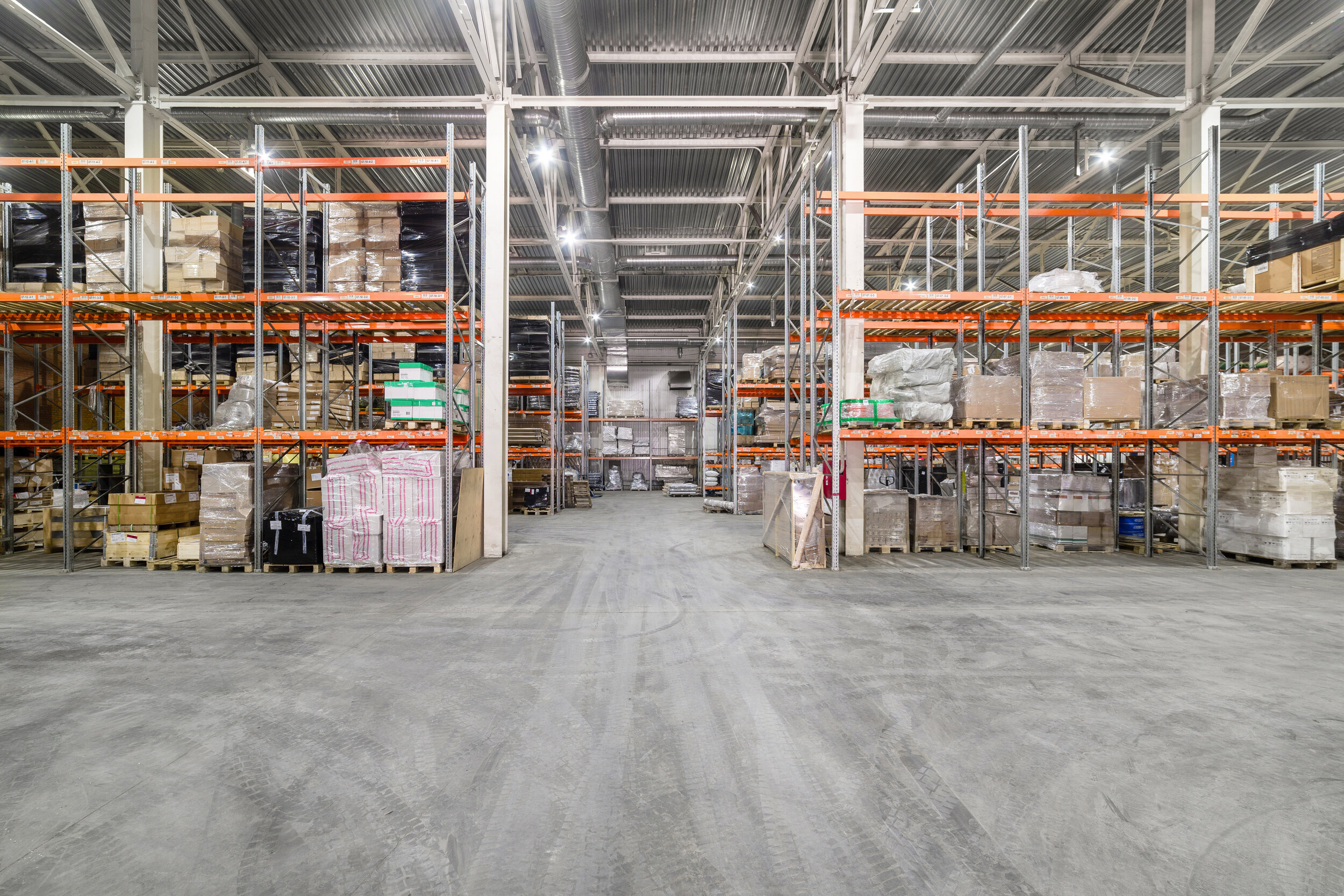
For industrial facilities- machinery, forklifts, handling equipment, and vertical storage all require precise concrete floor flatness. Lack thereof can increase chance of injury, loss of product, and damage to large equipment. Although rarely noticeable to an untrained eye, the impacts of a floor that is not flat are impossible to ignore.
For architects as well, modern designs require a similar preciseness. For example, glass walls and other popular design elements are all at the mercy of the flatness of the floor they will be placed on.
Rehabilitating and revitalizing existing structures also have a need for measuring floor flatness. Of primary concern among these are the settling of concrete over time. To successfully redevelop an existing facility, identifying the floor’s flatness is critical to successful tolerance and utility.
It is clear that measuring the precise flatness of a floor is of utmost priority to building development teams. But the priority is not new. Experienced teams are well-versed in the role and impact this priority has on timeline and long-term successfulness of building projects.
Although a historical concern, innovative teams are frequently searching for a better way. These teams are privy to the role that precision, efficiency, and accuracy all play in bringing construction projects to fruition. Because just measuring the floor’s flatness isn’t enough. The measurements should be precise. They should be done efficiently. And, the results should be accurate.
High definition laser scanning offers the best precision, efficiency, and accuracy to the process of measuring floor flatness. With speed unlike manual measurement, and collection of millions of points, digital scans identify and distinguish exactly where floors stand- competitively outshining historical practices.
Cutting-Edge Practices and Technology
Throughout the years, measuring to calculate F numbers (flatness) has taken a variety of methods. It wasn’t too long ago that technicians would lay a 10-foot straightedge on finished floor, identifying gaps and using these to calculate flatness. More recently, crews are deployed to walk slabs of concrete, take a variety of measurements, and generate a resulting calculation.
Both of these avenues leave great room for human error. In some instances, the straightedge method even presents discrepancies from technician to technician. In a similar regard, both of these tactics offer extensive manual labor, inhibiting work timelines.
In construction, time and value are often seen as contradicting. Developers are frequently forced to accept that accurate, precise results go hand in hand with extended timelines. In considering the value of precise floor measurements, it would be assumed that the process must be long to be accurate. But with 3D scanning, neither time nor accuracy must be sacrificed.
Laser scanning for floor flatness dramatically improves the three core areas of concern: precision, efficiency, and accuracy.
Here’s how it works:
Our survey and data collection technicians deploy cutting-edge scanners to the construction site. In just a few minutes, the floor space is scanned, collecting over thousands of single points that together form a digital rendition of the space at precise measurements.
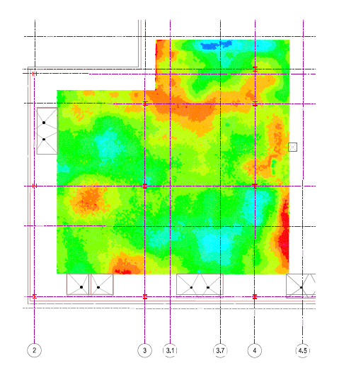
This is repeated a number of times, each time utilizing the same control or benchmark within the space. Multiple scans of the same space is a practice that increases accuracy. Utilizing the benchmark ensures precision among each scan. The scans are transferred to digital format, creating a 3D point cloud- all of the multiple scans, millions of individual points, layered on top of one another, and anchored by the control.
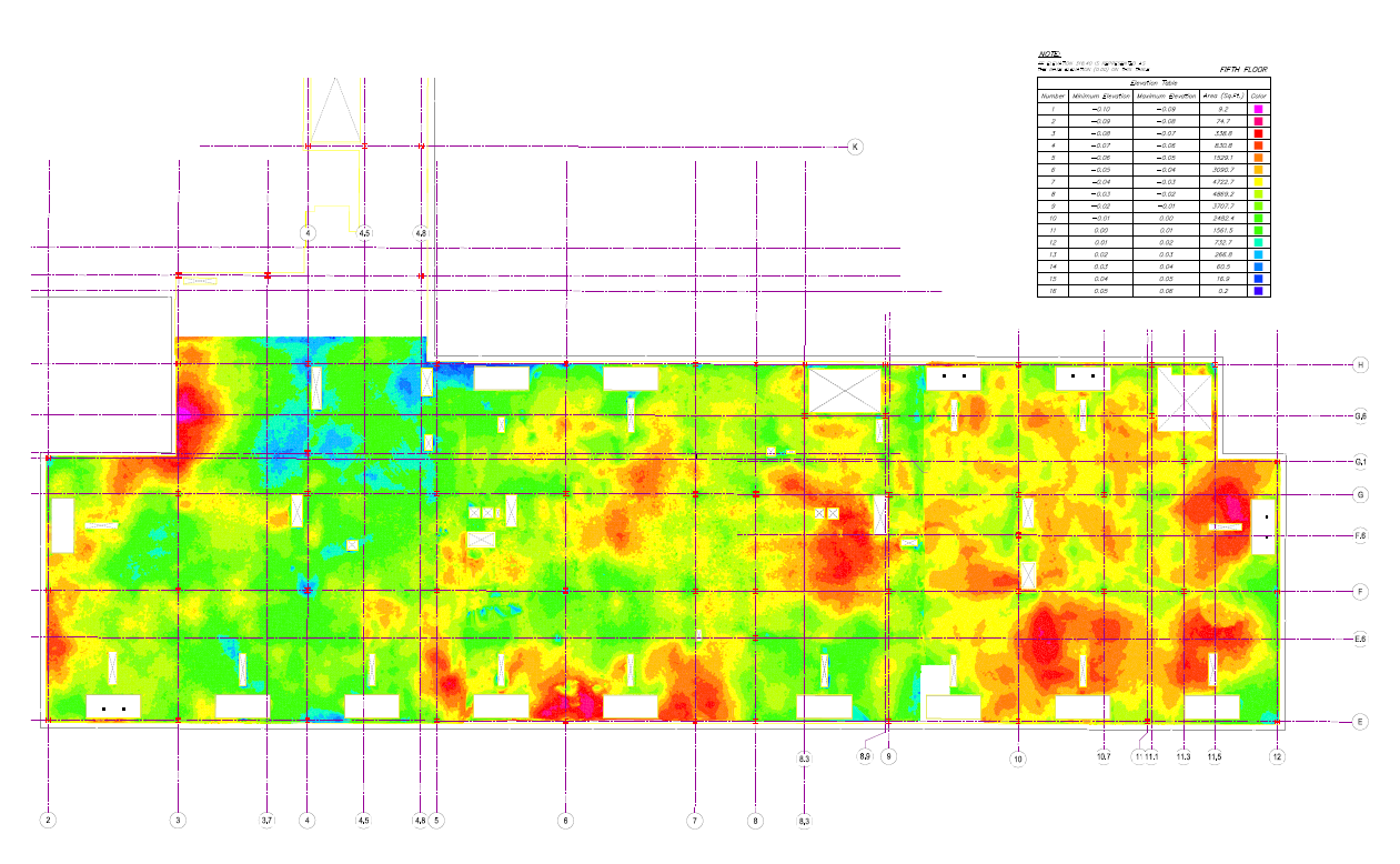
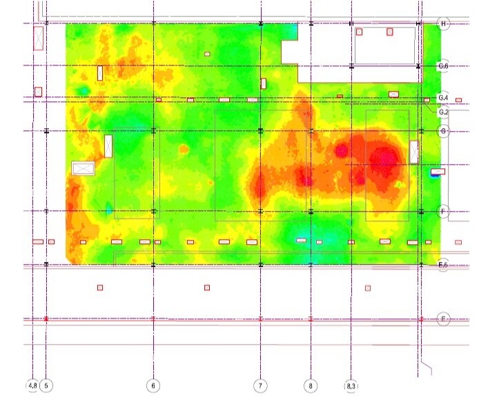
Digital scans of a space offer elevation information- identifying clearly the floor’s flatness. But scanning technology also offers the capability to calculate F numbers just as manual labor aims to do. Therefore, the technology reaches the desired conclusion in a better way, a faster way, and a more effective way.
Precision. Efficiency. Accuracy.

By collecting millions of points in minimal periods of time, laser scanning outshines manual labor and calculations. Technological advances decrease the opportunity for human error, and decrease the amount of time it takes to collect more information. And, this technology means not only more data, but more capabilities with that data.
21st century facilities shouldn’t be built with last century tactics.
We know that investing in cutting-edge technology and implementing cutting-edge practices changes the game for our clients. The outcome is evident- high definition laser scanning is the best way to measure floor flatness with precision, efficiency, and accuracy.
Looking to talk more about using scanning to measure floor flatness? Our Survey team would be happy to help. Send us an email at information@ssmgroup.com
#ProblemSolved: Read more about Survey and Data Capture.

Digitizing Hard Copy Maps
Advancements in GIS software and mobile applications have recently provided the ability to access maps and data on the go.
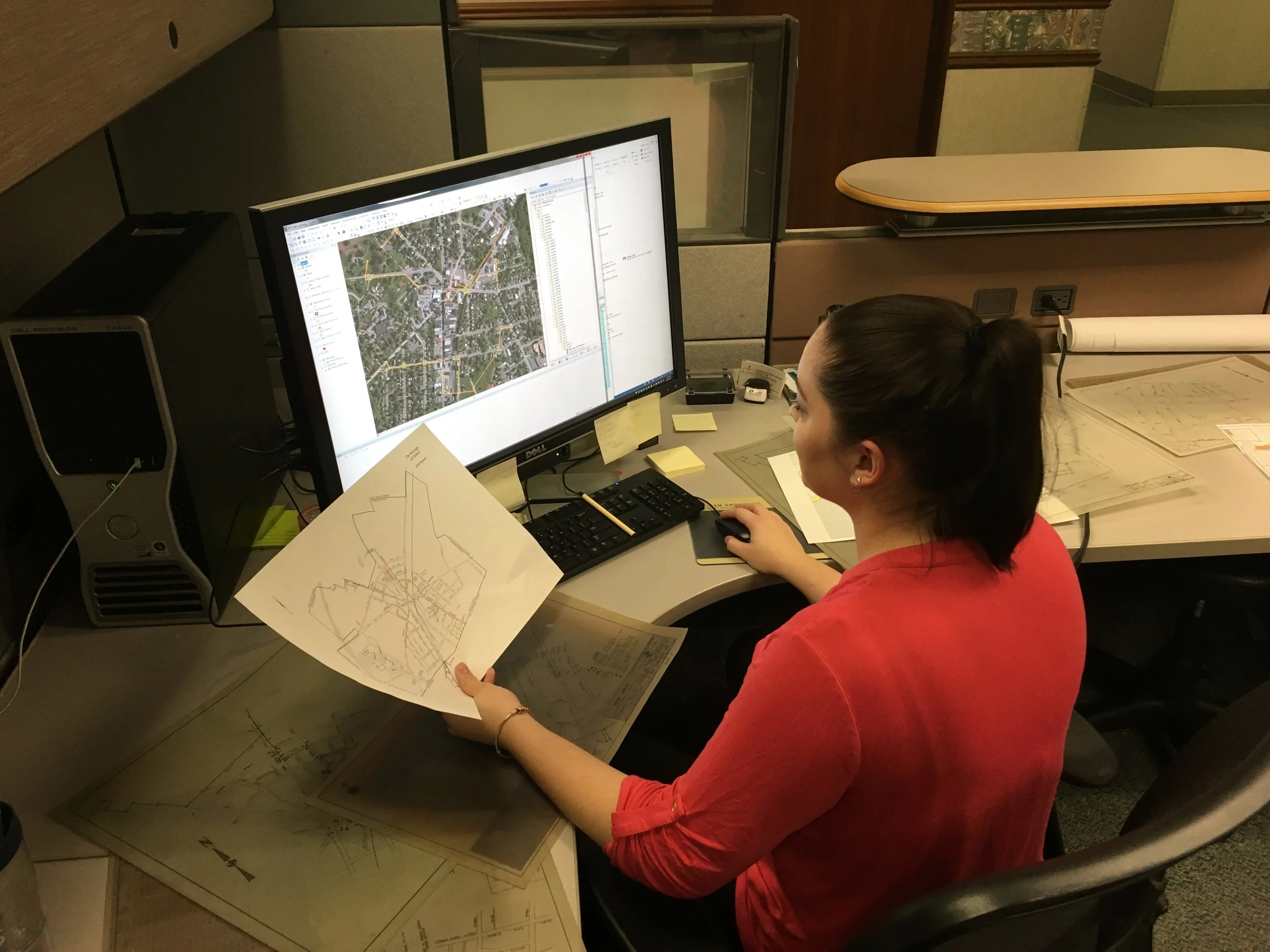
For decades, public utility providers and municipalities have used paper maps to maintain and keep track of their assets. Too often, these bulky, hard copy maps are still being utilized today, but many of SSM’s clients are opting to digitize their utility maps. Advancements in GIS software and mobile applications have recently provided the ability to access maps and data on the go. This allows managers and operators to access asset locations, specifications, photos, and customized maps and applications wherever they take their mobile device. For many, digitizing old maps is well worth the process.
The process begins by scanning the paper maps. Once the maps are scanned as an image file, they are then georeferenced using GIS software. This assigns real world coordinates to the image, allowing the features to be traced as a shapefile. Depending on how old the map is, or how accurately it was originally created, some inferring may be required to correctly place the data. After the data is digitized, it’s best to verify the locations, as things may have changed since the maps were originally created. Now you can access the data whenever and wherever you need it via computer, smartphone and/or tablet.

Online GIS Applications: A low-cost Asset Management Approach
Many water/wastewater systems use online GIS applications to transform their infrastructure data into an easy-to-use operations asset management system.
Geographic Information Systems (GIS) emerged in the 1970s and became accessible enough for deployment within local government and utility companies in the 1990’s. For the past 20 years, municipal authorities were sold on the power of GIS in asset management. But after investment in the hardware, software, and data conversion, many small water and wastewater systems found themselves with a system that is not living up to their expectations. Cost-cutting measures may have relegated updating and maintaining the GIS data to in-house operators with whisper-down-the-lane training. Hesitant to invest in a poorly-understood system, but eager to capitalize on the benefits, small utilities are seeking a low-cost, effective asset management approach. Recent advancements in web-based GIS applications, similar to Google Earth, have provided new means to create, store, and access GIS data.
Many water/wastewater systems use online GIS applications to transform their infrastructure data into an easy-to-use operations asset management system. This low-cost approach captures vital data within a secure geo-spatial database. By creating customized mobile web applications, field-critical data (material description, installation date, inspection reports and service history) is available when needed most and accessible to operators in the office or in the field.
Large water utility companies have invested significant capital resources in data capture, mapping, and management of their system assets. The massive amount of the data is contained within a centralized enterprise GIS database and made accessible by credentialed users. Operation and maintenance of large GIS datasets are conducted by a full-time GIS department. Small water systems would benefit from the same access to a GIS database, but are unable to dedicate the resources necessary to collect and maintain the asset data. An online GIS approach uses a similar data model, but scaled down to the appropriate size to meet the financial structure of the system.
The process of building an online GIS data system begins with the conversion of as-built plans to geographic data. Old paper maps are scanned to an image file. Through a process of georeferencing, the map is given a map coordinate projection. The features of the map are digitized to populate the geodatabase with geometry and attribute features. The geometry features are the geographic locations of the features, such as the exact location a fire hydrant or the run of a pipe. The attribute features are the information that is associated with each individual asset. Everything from the manufacturer and serial number to maintenance and performance history can be associated with an individual piece of equipment. Notes and annotation from the paper maps, such as “turns right” on valves, can be added to the attribute features to preserve institutional information about the system. The resultant geodatabase can be completely customized to the needs of the individual system.
Once the geodatabase is built, the data is presented in the form of online map applications. The locational data is visualized on a variety of basemaps, be it parcel street maps (as example below) or areal imagery. Selecting a feature brings up the relevant information regarding that feature. The maps are accessible to any device with a connection to the internet. That means an operator in the field, using his smart phone or tablet, will have the same access to the system information as a manager, sitting in the office at his computer.
Small Imperfections Matter
From high-speed racetracks to concrete floors measuring and modeling large surfaces can highlight small imperfections.
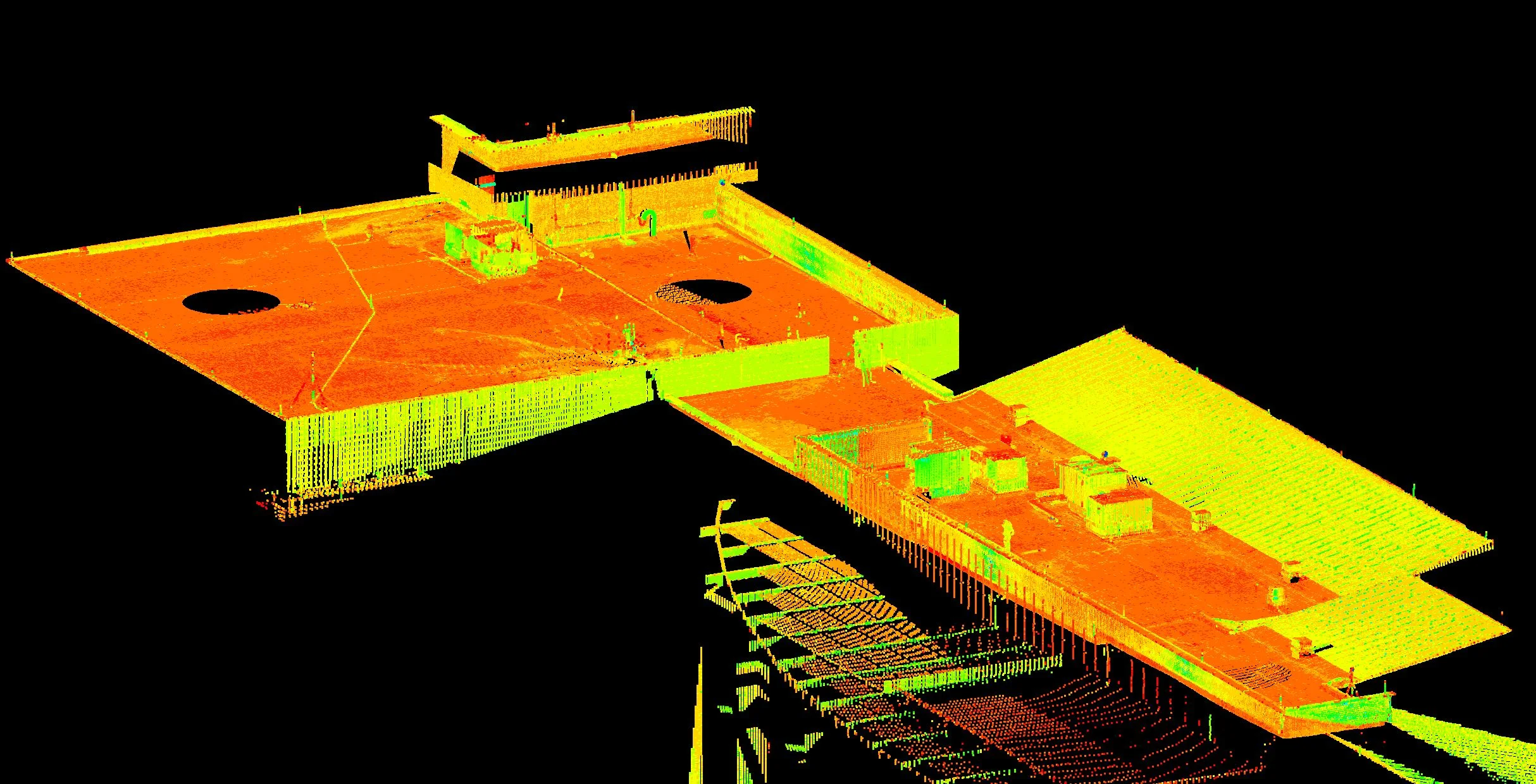
For complex surfaces or large areas of surfaces that require high levels of flatness or levelness, using a high definition laser scanner offers millions of coordinate data points for verification or detection of anomalies that cannot otherwise easily or quickly be acquired. From offices to high density storage facilities, synthetic surface playing fields, to high-speed race tracks, the ability to rapidly and accurately measure and model large surfaces can highlight the small imperfections that can make a big difference.

In West Whiteland Township, post-construction high definition surveying was utilized over 12,000 square feet of concrete floor to identify irregularities in placement that prohibited the installation of finishes, equipment and furnishings. Contour plans with color banding and spot elevations to demonstrate where problem areas were located, with 1/8-inch accuracy aided the client and contractors to swiftly repair and to rule out structural deficiencies. A similar analysis was performed for the roof to identify slope and stormwater drain placement.
FOR MORE INFORMATION: Patrick McCoy, PE, LEED AP, CSDP