
Existing Structure and Landscape Conditions
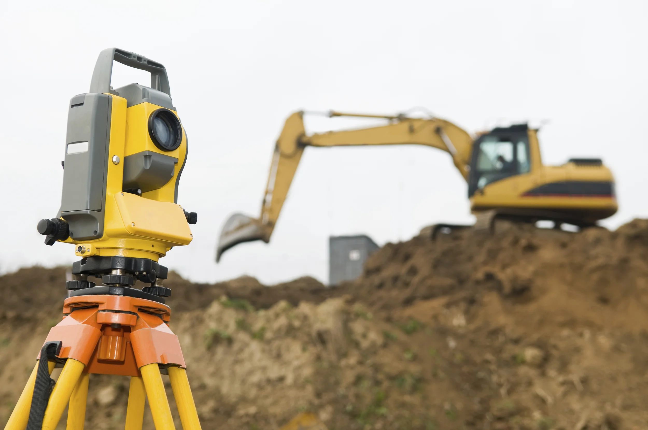
SSM utilized high definition laser scanning equipment and software to quickly and accurately capture the existing structure and landscape conditions.
ATKIN-OLSHEN and CVM
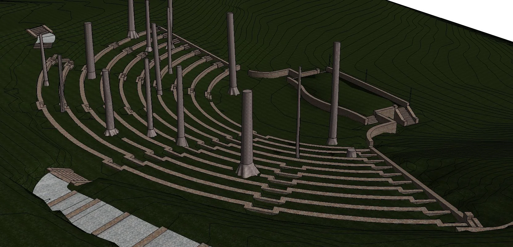
Swarthmore College Scott Amphitheatre
Scans: 8Scan Time: 1 day

Working for Project Architect Atkin-Olshen, and CVM, the structural engineers responsible for designing a proposed removable canopy and supporting structures for the existing 50-year-old open-air Amphitheatre, SSM utilized high definition laser scanning equipment and software to quickly and accurately capture the existing structure and landscape conditions. These services were employed to enable the project team to design the renovations in a 3‑D environment. The Revit model and accompanying point cloud allows the team and owner to design and then view the effects their design will have on the multi-terraced levels, stone retaining walls and mature trees. In addition, SSM utilized an existing topographical survey plan that was imported into Revit and used as supplemental background information.
SSM delivered the following:
An accurate 3D model of the Ampitheatre developed in Revit. The point cloud data was included in the Revit drawing.
Leica Tru-View of each scanner position. Leica Tru-View is a free web-based tool allowing the user to view the point cloud and field photography together, to easily and quickly “re-visit” the scanned areas of the building. Tasks such as panning, zooming, acquiring measurements and mark-up tools are all functions of the Leica Tru-View Software.


Structural Assessment for Pier Certification
SSM utilizedthree-dimensional scanning to locate and identify the magnitude of surface irregularities in pier.

PIER #5
Rhoads Marine Industries
Philadelphia, Pennsylvania
Pier #5 | As required by ordinance in the City of Philadelphia, waterfront structures are subject to triennial inspections to ensure there are no hazards to occupants of non-vacant piers. SSM commenced this process using three-dimensional scanning of the surface of the pier to locate and identify the magnitude of surface irregularities in pier. The framed construction of the pier requires inspection of the underside via boat at favorable tide and dive monitoring for the supporting piles.
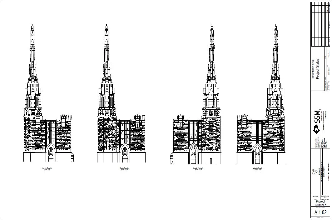
High Definition Scanning and AutoCAD Modeling
SSM utilized high definition laser scanning equipment and software to quickly and accurately capture the existing facade conditions of the church’s 150-foot bell tower.

BRYN MAWR PRESBYTERIAN CHURCH | EXTERIOR SCAN
CVM Engineers
Bryn Mawr, Pennsylvania
SSM utilized high definition laser scanning equipment and software to quickly and accurately capture the existing facade conditions of the church’s 150-foot bell tower. These services were employed to enable the project team to understand the design the displacements of the masonry elements in a 3‑D environment to ascertain structural conditions. The AutoCad elevations and sections and accompanying point cloud allows the team and owner to design and then view the existing conditions and effects of any proposed repairs.
SSM delivered the following:
Elevation of each side of the tower portion of the church delivered as a 2D Autocad drawing. The portion of the tower, from the parapet base to the top of highest point was highly detailed to show cast stone ornamentation and the location of each of the stones in the aforementioned portion and include general geometry for the balance of the tower (to ground level). SSM documented planar distortion to indicate how far the top portion of the tower as well as the parapet walls may be leaning.
Leica Tru-View of each scanner position. Leica Tru-View is a free web-based tool allowing the user to view the point cloud and field photography together, to easily and quickly “re-visit” the scanned areas of the building. Tasks such as panning, zooming, acquiring measurements and mark-up tools are all functions of the Leica Tru-View Software.
HIGHLIGHT: The 11 scans were performed in 1 day.


Monitor Wall Movement - High Definition Scanning
High definition laser scan of a thirty foot high retaining wall
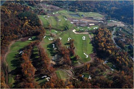
LEDGEROCK GOLF CLUB
LedgeRock Golf Club
Mohnton, Pennsylvania
High definition laser scan of a thirty foot high retaining wall to monitor movement in both the vertical and horizontal directions. A survey base plan and data table calculating the movement were created using the scan data.
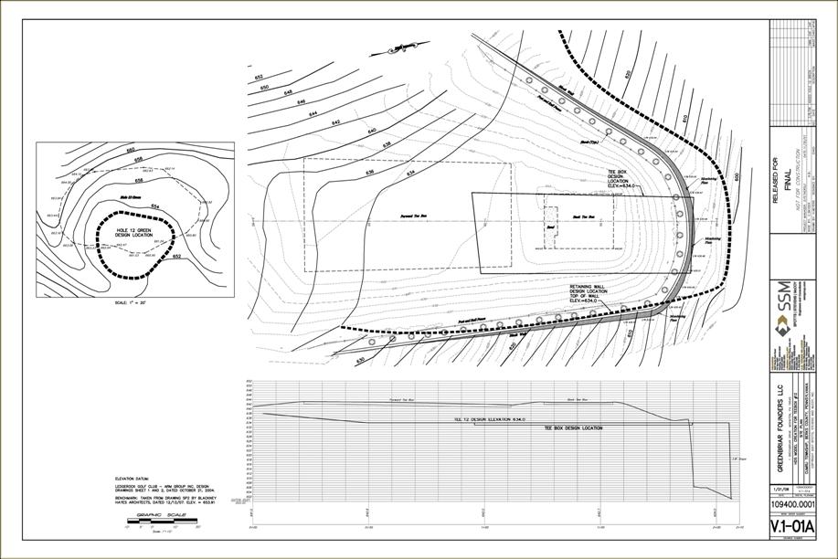
LEDGEROCK GOLF CLUB TEE BOX

Surveying Services
Manage surveying services for all aspects of landfill operations
Southeastern Chester County Refuse Authority (SECCRA)
West Grove, Pennsylvania
Manage surveying services for all aspects of landfill operations, provide survey stakeout support, as‑constructed survey and certification plan preparation for new cell construction and final capping/closure projects.
Conduct semi-annual mine subsidence survey on portion of landfill property, provide continuous survey support and grade control for waste placement, all phases of gas mining activities, infrastructure construction and maintain posting of critical boundary lines such as: property, waste limits, liner edges, permit boundary and wetlands.
Provide monthly surveying for volumes of waste placed, remaining airspace, compaction rates and daily cover consumed also all services related to annual aerial mapping of the sites.
Surveying Services
Managing surveying services for all aspects of landfill operations including survey stakeout support, as‑constructed survey and certification plan preparation for new cell construction and final capping/closure projects, and continuous survey support and grade control for waste placement, all phases of gas mining activities and infrastructure construction.
Republic Services/Consestoga Landfill
Berks County, Pennsylvania
Support General Operations
Monthly and annual waste volume and compaction reports
Generate annual aerial mapping data
Survey control for all grading aspects of landfill operations including waste placement and borrow soils for daily cover
Establish, monitor and distribute all GPS and conventional survey control for the sites
Construction layout and As-Constructed survey for all facility construction or modification
Bi-annual Mine Subsidence survey for earth stability
Survey support for Landfill gas mining operations
Construction Phase survey and certification of new waste cells and capping/closure
Construction survey for all phases and layers of new waste cell design
Sub-base, LDZ, LCZ, GCL, LPS Clay, Liner materials, Piping, Pump House and Protective cover
Develop GPS ready 3-D Grade Control models for On-Board grade control software to be used by site contractor
Draft all certification plans for submission to PaDEP
Survey and document all destructive testing, liner seams and trenches
Construction survey for all phases and layers of new waste cell design
Survey of waste grades, Intermediate Cover, Capping materials and Final Cover
Draft all certification plans for submission to PaDEP
Supporting Services
Survey or delineate any permit driven lines of control such as Wetlands, Property Lines, Waste Permit Boundary Lines and surrounding buffer area impact elements
Continuous survey support for new projects or design including existing conditions survey, construction staking of new designs and As-Constructed survey and reports of installed design components
Survey and plan preparation of land acquisition and subdivisions
Current and Historical mapping of site development to be used in quarterly and annual reports.