
Make your Data Work for You
Your data should be understandable. It should be reliable. And, it should be accessible.

Facilities, businesses, organizations, municipalities, and individuals are all dealing with a data problem. All over, people are collecting great data and not putting it to work. Hours, days, months are spent gathering data, sorting, re-sorting, and re-sorting again to analyze it for a particular need. Or worse… data is collected over and over again and ends up sitting and going to waste.
Your data should be understandable. It should be reliable. And, it should be accessible.
GIS technologies allow you to make your data work for you. Instead of storing information in multiple locations- maps, spreadsheets, notepads, clipboards, cell phones, email chains- now we have the ability to put it all in just one, single place.
With GIS technology, data can be accessed on multiple devices from various users and at any time. It allows you to continuously and consistently revise- so your information is always up to date. With GIS, data makes sense.
GIS software links geographic information (the where) with descriptive information including data, comments, pictures, and more (the what). Data doesn’t have to be just numbers on a screen or photos in a folder.
By compiling all of these things into the visual representation of a digital map- your data begins to work for you.
While flat maps and standard database systems offer you the surface, GIS technology takes what you know on a deeper level- allowing you to better understand the relationships, the patterns, and the connections between things that happen and why.
Because when data tells a story, you’re able to make smarter decisions in a shorter time.
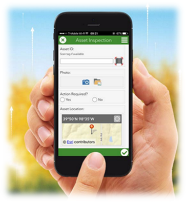
But it doesn’t stop there. Through GIS, we have also been able to streamline data collection while maximizing efficiency. Throw the clipboards and blank paper forms away. Instead, all field team members need is a smart phone or a tablet. Customized data collection apps allow you and your team to gather data (pictures too!) with smart devices and it is immediately populated into your GIS map. No filling out forms. No copying forms into spreadsheets, or rewriting maps onto other maps. Instead, it’s all in one place and it remains as up to date as you are.
Interact with your data. Make sense of your maps. Find out the answers that you need to know. ….try doing all of that on paper.
Beyond Maps
Go beyond maps, let data work for you.

We could amaze you with the endless ways that GIS solves problems in our world every single day.
Businesses and banks can and do use GIS to better understand their target markets, their financial risks and gains, and increase their profits. Facilities managers use GIS to manage their assets and plan for the future. Journalists and media outlets use GIS to tell great stories and research better information. Public health professionals use GIS to track disease spread and outbreak crises. Governments, education leaders, community planners, public safety specialists, transportation managers, archaeologists, geologists, scientists, and more- they all use GIS.
What we want you to know is that you could benefit from GIS, even if you don’t know how. And we’d love to help.
Sometimes, it’s a problem that tells you it’s time to come up with a better way. Other times, through streamlining processes and effectively corroborating data- a problem presents itself and prevention is the focus. In other cases- it just feels good to have everything in one spot.
Kickstart GIS into your world. Start out small- what data are you already collecting? Maybe you don’t even realize you’re collecting data! Look at what you have- start there. Then think about what data you wish you could collect.
Sometimes, use of GIS leads to further questions. So, start small. Consult the GIS experts that you know (we have a few). Input what you have now. As you work with the technology, you’ll begin to uncover more questions- the more questions you have, the more data to collect, the more answers to discover.
Go beyond maps, let data work for you.

Great Data is Meaningless if you Can’t Access It
Despite their map, despite their data, it took that water authority 8 hours to locate and turn off the water valve.

In 2013, a water main broke in the middle of winter. The water authority rushed into action. First step was to shut off the water at the valve to stop the water from endlessly shooting out the broken main. They got their map and headed out to the location indicated on the map. As it turned out, the location of the main was in the middle of a park. So, while normally a to-scale map offers landmarks and points of reference to quickly pin point the exact location- in this instance, that wasn’t quite the case. To make matters worse, everywhere the eye could see was covered with a foot of white snow. The only option was to guess and check. Despite their map, despite their data, it took that water authority 8 hours to locate and turn off the water valve.
Following that event, the authority decided they can never allow that situation to happen again. So, they set out to gather every critical water system asset – such as shut-off valves – and store it in one GIS map. Available through mobile applications, the online GIS data is accessible in the field. They can better assert and effectively confirm their location, allowing for quicker decision making and better problem solving.
Since 2013, SSM and other partners have worked with the water authority to collect every single water asset point in the authority’s geographic reach and input it into an interactive, up-to-date GIS mapping system. Now, when the water valve needs to be shut off at any location, in any weather conditions, the field team will take their smart devices and pinpoint their exact location alongside the exact precise location of the valve. Less time, less damage, more effective.

Make your Data Accessiblle
What if the team could actively interact with the map, seeing exactly what they’re looking for- exactly when they need it- and with exactly perfect accuracy?
With GIS technology, they can.

Picture this: A wildfire breaks out in northern Pennsylvania. Local firefighters are ready to act. They pull out their maps to pinpoint exactly where the fire is occurring. Next, it’s time to make a plan of action. How will we attack this? How will we fight it? How will we ensure the least possible damage?
First, determine the route to take- what are the local roads towards this forest and what’s going to be the fastest way to get there? The team cross references their road map with their forest map and settles on a good route to take. Next, assess if there are any priorities nearby to protect. Break out the database of land/home properties, break out the database of local schools and businesses, and break out the database of wildlife refuge centers. Cross reference all three with each other, and also compare them to the forest map and location of the fire at this exact moment in time. Lastly- assess the major threats, risks, and benefits for the team. Pull out another database and find out the nearest trash collection facility, pull out another database and figure out the nearest hazardous waste facility, and pull out one more database to locate the nearest gasoline station. Now that two maps and six databases have all been cross-referenced, it’s time to fight the fire. Just hope nothing’s changed since the last time those maps were printed.
We’re not sure about you- but that plan is just not good enough for us. What if all of this information was in one single spot? Imagine if it was in one spot that firefighters in 10 different trucks could all access at the same time while enroute to the forest fire? What if the team could actively interact with the map, seeing exactly what they’re looking for- exactly when they need it- and with exactly perfect accuracy?
With GIS technology, they can.
Take it one step further: GIS doesn’t just save us in the event of emergencies. Let’s take the wildfire one step further. What if the team reviewed the fire even after it was over? They tracked where it started, where it spread to, what the weather was, when the date was, what time it was, what propelled the fire and how long it lasted. (All in that one special GIS spot, of course). Let’s say the team did this with every single forest fire that occurs.
By inputting all of this data into an interactive and visual map- it’s no longer a generic record of natural disasters and their dates and details. Instead, it’s an opportunity to identify patterns, locate risks, and even distinguish connections to what happened and why- opening the door for effective prevention and preparation in the future.

The Everyday GIS User in You
You are probably using GIS technology in your everyday life, if not many times a day.

GIS technology isn’t just for the firefighters and the business owners. It also isn’t a new fancy technology. In fact, you are probably using GIS technology in your everyday life, if not many times a day. Don’t believe us? Here are just a few ways you’ve probably used it.
Looking to buy or rent a new home? Those phone apps are so convenient- you just open up the map, choose the specific location, and it shows all of the homes along with data about their prices right there in one visual spot. In some cases, it even color coordinates the icon for each home depending on if it is for sale, pending, or closed. Surprise! You just engaged with GIS. All the data, one spot. Easy and interactive.
What about when you are on vacation, or driving somewhere new? Do you ever utilize maps on your phone to locate the nearest gas station or coffee shop? You’re utilizing GIS! Here, the map goes beyond just a map. Instead, it offers extra information such as names of businesses, color coordinated by type of business. There’s also another layer- do you know how those roads turn red when there’s traffic? That’s all data, corroborated into one spot on one visual map. As vehicles (with smart phones) travel roads, data collection assesses how quickly the sets of cars are moving- establishing when there is a significant hold up on roads according to their speed limit. Which reminds us- when you’re using that GPS and it tells you the speed limit for that road? GIS.
The help that comes if you are ever in an emergency? They depend on GIS.
Google Earth- where you probably have looked up your own home on multiple occasions? GIS.
Are you a social media person? Do you find it amazing when you take a selfie and upload it to social media and it suggest your location? Be amazed no more- it’s GIS!
Marketing professionals use GIS as well. Do you ever feel like your internet knows exactly what you’re looking for or exactly what is happening around you? In some ways, they do. Marketing professionals use GIS to analyze data of potential consumers. By looking at purchasing data, location data, search data, and a lot more- they can establish what they should be putting out to you and when.
GIS is going beyond maps. It’s information. It’s data. It’s interactive. And, it’s meaningful. Information, correlated with geography- that’s GIS.

SCIENCE | TECHNOLOGY | ENGINEERING | MATHEMATICS
We are so grateful for all of the people and experiences that at one point inspired our employees to pursue their interests in Science, Technology, Engineering, Art and Math. And we are grateful for all of the people and experiences that will inspire our future employees for years to come. To celebrate #STEMSTEAMDay today, we’ve shared a few stories of how some of our people made their way to us.

Celebrating just a few of our employees and the people and experiences in their lives that inspired them.

Sydney Jernigan - Graduate Engineer

Katie Baltzley - GIS Specialist

David Kresley - IT Specialist

Alex Nawotka - Environmental Specialist
SYDNEY JERNIGAN | Graduate Engineer
I have always loved math. Even as a kid. I loved using formulas and critical thinking to come up with an answer. I remember in 5th grade we had these math workbooks. We were assigned a page every night to complete- about eight problems. My teacher would scold me for completing 10 pages at a time, because I was moving so far ahead of the class. In high school, when it was time to start thinking and talking about college, I knew I loved math and wanted to apply those skills. But, I had no idea what I wanted to do. My geometry teacher, Ms. Gallagher, first told me to consider engineering. I did some research and realized that was exactly what I was looking for. The idea of engineering is to use critical thinking to create solutions. This is what I’ve always loved growing up. (It was also a bonus that throughout college I was constantly doing math homework like in 5th grade). It’s thanks to Ms. Gallagher, my high school teacher, that I ended up where I am today. I can’t imagine having any other career now.
KATIE BALTZLEY | GIS Specialist
I had amazing parents growing up. My dad, an avid outdoorsman, always taught me about the importance of protecting wildlife and stream health. I have memories of spending summers playing in local creeks, and pulling over in the car to help box and snapping turtles cross the road. (I still do this, to this day!) My mom always encouraged me to look up to the sky. She would wake me up at 3 AM to catch a lunar eclipse. Or, we’d lay out blankets on the lawn so we could stay up late and watch meteor showers. My dad’s love for the beauty of nature and my mom’s enthusiasm for the world around us both led me to my future. I went on to major in Geography with a focus in Environmental Science and minor in Meteorology. Now, I get to create interactive maps that help educate others on source water protection and the wonderful world around them.
DAVID KRESLEY | IT Specialist
My love for technology began with my dad. One time, a computer that he used broke and he told me to “try to fix it” even though I was only in the 2nd grade and had no clue how to even begin. The inside of the computer reminded me of Legos. There were a bunch of important pieces that belong in their place, all serving their own purpose for one final result. In 5th grade I got a brand new computer that was setup right next to my dad. Here, I started to learn the parts of computer, and how to upgrade whole computers or individual components to make them more powerful. Every computer I’ve had since that first Dell tower has been built with my own hands. The idea that I can make a computer look how I want it to look and make it as powerful as I want it to be is still an idea that gives me a sense of wonder. From sitting next to me in my early memories to running Ethernet cable through our walls and attic- my dad helped to create my foundation of knowledge and understanding. Now, I’m an IT Specialist and do what I love every single day.
ALEX NAWOTKA | Environmental Specialist
There are so many moments in which I found my love for science. I remember finding awesome-looking stones at the edge of the forest when I was eight and taking them home with me. (I actually still have them.) I can remember really falling in love with my future career in middle school. My teacher set up a sand table experiment for us. You have sand and mud in a large, shallow crate, and you carve whatever stream shapes you like in the sand with your fingers, and add water. Through this experiment, you get to see a miniaturized version of erosion and channel meandering, and how sand moves with water versus how mud moves with it. I still remember thinking that was the coolest experiment we did all year! Years later when I had to choose a major in college, that sand table was one of the memories that helped me to make my decision.