

Case Study: Field Inspection Applications Using Mobile GIS Technology
SSM is working with South Heidelberg Township on the development and deployment of field inspection applications using mobile Geographic Information Systems (GIS) technology.
SSM is working with South Heidelberg Township on the development and deployment of field inspection applications using mobile Geographic Information Systems (GIS) technology. This technology will modernize the Township’s operations and maintenance as well as contribute to a more efficient workflow. SSM is providing multiple inspection applications, all of which include training to Township staff on how to use the GIS applications.
Stormwater Facilities Inspection Applications
Populated the existing GIS database with current information, such as outfall descriptions and existing land use within outfall drainage areas.
Deployed mobile GIS-based field inspection applications for the routine inspection of stormwater outfalls within the Township. Data collected using the outfall inspection applications will be used to generate PaDEP MS4 Outfall Field Screening Report.
Development and deployment of field inspection applications to gather information and assess the condition of stormwater infrastructure assets throughout the Township.
Transportation Inspection Applications
Development and deployment of mobile GIS-based field inspection applications for the routine inspection of street signs and road conditions within the Township.
Sanitary Sewer Manhole Inspection Application
Development and deployment of GIS-based field inspection application for the routine inspection of sanitary sewer manholes within the Authority’s system.


In Action: Field Inspection Applications Using Mobile GIS Technology
This month, Katie Baltzley, Senior GIS Analyst, accompanied the South Heidelberg Public Works crew in deploying the second round of this project: the Street Sign Inspection Application.

This month, Katie Baltzley, Senior GIS Analyst, accompanied the South Heidelberg Public Works crew in deploying the second round of this project: the Street Sign Inspection Application.
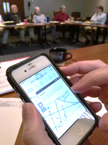
The GIS team at SSM created the GIS workflow and mobile application that allows the Township staff to log road sign inspections with mobile devices as well as attach photos of every road sign. All of the inspections and data are saved in ArcGIS online and accessible to Township staff through a Sign Management Dashboard designed by our team.
This electronic ability to map out all of the Township infrastructure and assets (stormwater facilities, street signs, sewer lines, manholes, etc.) is increasing the modernization and efficiency of the Township staff and workflows.
In action the workflow is as follows: The Public Works members inspect signs to determine the condition of those signs and what signs are in need of replacement. All of the data collected (including photos) is stored in an online database with access through a management dashboard (photo above) which then assists the Township in ensuring proper timelines and maintenance of signs. The data also assists in proper planning of budgets for sign replacements and repairs in future years.
Deployment of this application is the second phase of the Township’s GIS program - initiated with stormwater inspection and being followed by sewer/sewer manholes.

Geographic Information Systems and Asset Management
SSM provides professional GIS services to municipalities; from mapping support for infrastructure projects, to focused GIS and data capture projects. SSM’s GIS Asset Management approach helps municipalities to transform sewer infrastructure data into an easy-to-use operations asset management system capturing vital infrastructure data points with survey-grade accuracy. The data is verified and compiled into a geo-spatial database.
SSM provides professional GIS services to municipalities; from mapping support for infrastructure projects, to focused GIS and data capture projects. SSM’s GIS Asset Management approach helps municipalities to transform sewer infrastructure data into an easy-to-use operations asset management system capturing vital infrastructure data points with survey-grade accuracy. The data is verified and compiled into a geo-spatial database.
GIS Database Development
GIS Training
ArcGIS Online Implementation
Mobile Application Design
Field Data Collection
Survey Grade GPS Collection
Customizable Inspection Forms
Field Inspection Reports
Document Management
Sewer Manhole Inspections through Integrated Mobile GIS Technology
Traditionally sanitary sewer manhole inspections are conducted by field inspectors, filling out a blank inspection report form, using pen and paper. Utilizing mobile GIS technology, the process can be streamlined, eliminating the need for paper forms and clipboards. A customized manhole inspection app guides the inspector through a series of questions where answers range from yes/no or multiple choice to free-form responses. Working directly with the collection system’s existing GIS data, the inspection app pulls manhole information (such as manhole ID#) into the form, and when complete, pushes the collected information back into the GIS. If the system does not have GIS already in place, the manhole inspection app can be used to initiate system-wide GIS implementation.

Case Study: GIS Mapping for Sanitary Sewer Rehabilitation and Investigation
SSM provided assistance to the Norristown Municipal Waste Authority (NMWA) for over 15 years for compliance with a PA Department of Environmental Protection Consent Order and Agreement to eliminate combined sewer overflows (CSOs) and excessive Inflow/Infiltration from the sewage collection system. SSM performed extensive Inflow/Infiltration (I/I) investigations and program management, including manhole inspections, building and outside property inspections, and some smoke and dye testing of roof leaders, foundation drains and parking lot storm drains.
SSM prepared and calibrated the hydraulic model of the Authority’s 60-mile sanitary sewer collection system and performed Sewer System Evaluations and cost-benefits analysis for various projects, including alternatives analyses for several sewer rehabilitation projects. SSM also prepared an extensive conceptual design and analysis of alternatives for the WWTP.
SSM provided extensive GIS Mapping of the NMWA’s sanitary sewer collection system to include 60 miles of sanitary sewer. The GIS database was used to prepare and calibrate a hydraulic model of the sewer system and to provide maps for use in Inflow/Infiltration (I/I) investigations and program management, including flow metering locations (pre- and post-rehabilitation), manhole inspections, building and outside property inspections, some smoke and dye testing of roof leaders, foundation drains and parking lot storm drains. GIS database management was utilized in order to map the results of televising investigations and flow metering, as well as to provide recommendations for non-invasive inflow reduction methods for property owners. SSM provided guidance to NMWA staff for collecting data from property surveys which was then incorporated into the GIS database. This mapping was later incorporated into the NMWA’s Combined Sewer Overflow - Long Term Control Plan for submission to the PA DEP, including the Nine Minimum Controls update for CSO 003.