

Reaching New Heights
We are using drone technology, HDS and BIM on our projects to enhance our collaborative relationships with outstanding results.

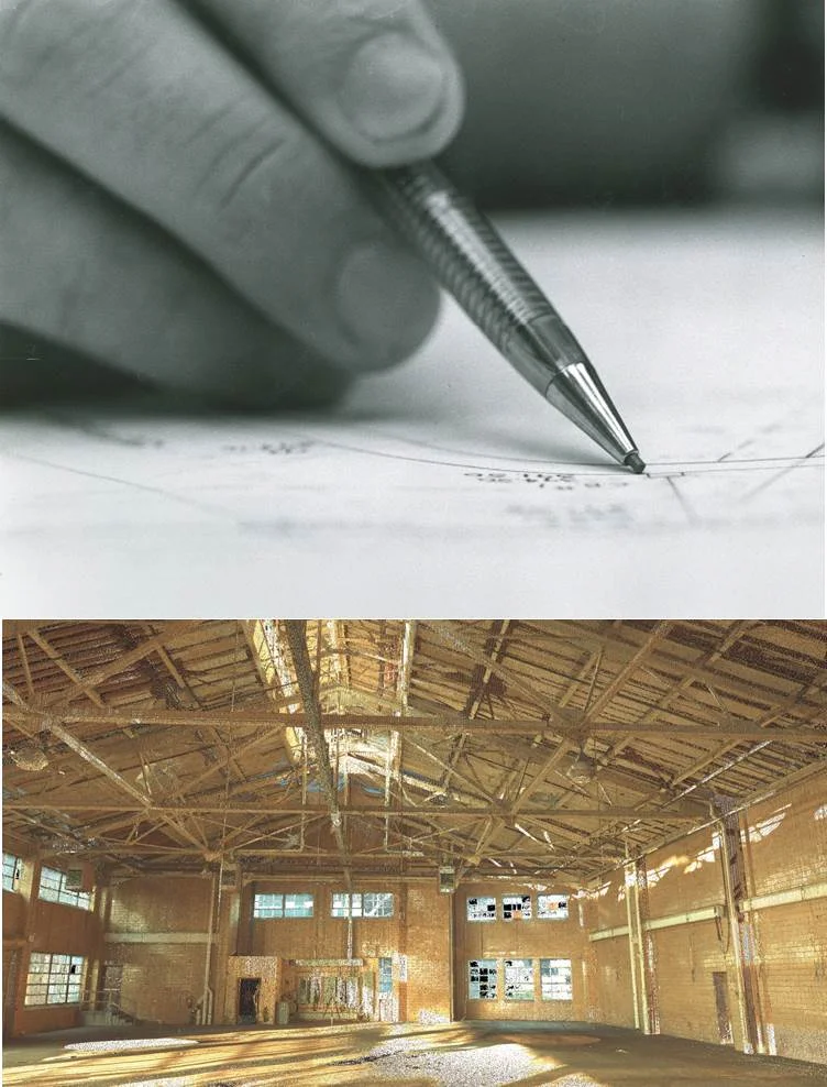
We are using drone technology, HDS and BIM on our projects to enhance our collaborative relationships with outstanding results. We can measure things that couldn't be measured before, capture images of existing conditions for future reference, bring information to your fingertips as well as create reference points for future site considerations. Drones are a powerful solution for monitoring construction, capturing hard-to-reach details, and documenting infrastructure on expansive sites.
APPLICATIONS
- Construction Monitoring
- Volumetric Computations
- System Layout
- Hot Spots/Heat Loss Detection
- Litigation Support
- Aerial Site Evaluation
- Rooftop Evaluations
- Erosion and Damage Assessments
We know data.
We utilize advanced hardware tools in the surveying business with the latest software tools available for architects and engineers to prepare high-accuracy, 3D virtual models for presentation, design documentation and construction coordination.
High-Definition Laser Surveying (HDS) is a non-intrusive, non-contact method to obtain three-dimensional geometry measurements and models of existing structures and sites for both large and small-scale projects. SSM is using HDS for campus master planning, historic building preservation and industrial complexes.
Quickly map and model large, complex sites and structures and visually show modifications
- Accurate measurements of areas that were once thought of as too dangerous or difficult to access
- Acquires as-built information inside and outside of any structure quickly and efficiently
- Used under any lighting conditions
- Allows for “virtual” revisit of the same site or structure
- Overlays of digital photos can be added

Building Information Modeling (BIM) is more than a 3D virtual model, it is a powerful database and collaborative design and management tool that can be used throughout the lifecycle of a building. Those that use it know it works; and can measure their savings in terms of dollars, time, and labor, by reducing or eliminating incompatible elements of the design early in the process when it’s less expensive to make changes.
As an evolution of computer aided design, BIM is quickly becoming the preferred approach for design construction and operation of renovated and new buildings. SSM’s facilities engineering staff utilizes REVIT BIM (Architecture, MEP and Structure) and we are on the leading edge of our industry by incorporating HDS and BIM in deliverables and our design process.

Implementing innovative water and wastewater treatment technologies for decades.
The First Egg-Shaped Digester Treatment System in Pennsylvania: Planning, engineering design, and construction management of wastewater treatment system for the Borough of Kutztown.
1.35 MGD Vertical Loop Reactor Oxidation Ditch for Birdsboro Municipal Authority Wastewater Treatment Plant.
The First Egg-Shaped Digester Treatment System in Pennsylvania

Innovative treatment technologies
Planning, engineering design, and construction management of 1.5 mgd wastewater treatment system for the Borough of Kutztown. The project utilized an innovative treatment technology called the egg-shaped digester system. The digester has a unique egg-like shape, which accounts for many of the benefits claimed by its supporters. Sludge in an egg-shaped digester (ESD) can be mixed more completely and with less energy than can a conventional cylindrical-shaped digester. There are no "corners" or dead spots in the tank where mixing does not occur or where solids can settle out. This results in a more efficient and more complete digestion process with higher gas production. The steep sloping sidewalls at the bottom of the egg keep grit and heavy solids moving until they reach the bottom of the tank where they can be removed or resuspended. The converging sidewalls at the top of the egg concentrate the scum making removal relatively easy. The major benefits of this type of system were a high rate of gas production, a sludge heating system that utilized digester gas rather than fuel oil as previously used to heat the sludge, and a 2% increase in digested sludge solids. The social implication of this is that a more highly processed sludge will be produced and it is intended that the excess renewable gas will be used for on-site power generation for some plant needs and thus reduce commercial power usage.
The ESD was the first such unit in Pennsylvania. It received an Engineering Excellence Award from the Pennsylvania Consulting Engineers Council.

1.35 MGD Vertical Loop Reactor Oxidation Ditch
BIRDSBORO MUNICIPAL AUTHORITY WASTEWATER TREATMENT PLANT
SSM designed the Wastewater Treatment Plant upgrade for the Birdsboro Municipal Authority to meet the NPDES permit limits and be in compliance with a PADEP consent order. The innovative design of the vertical loop reactor (an oxidation ditch turned on its side) allows for the mixing and aeration to be provided by disc rotors supplemented with coarse bubble air diffusers for aeration. The WWTP is capable of handling high peak flow and provide nitrification and denitrification within the same tank providing a small footprint on the limited space on the WWTP site. A slurry wall utilizing high clay content material installed below grade shaped the barrier walls that surround the WWTP. The wall was constructed to prevent water from percolating through the ground under a dike and allowing the WWTP to be protected during potential flooding events.
Answering the multi-faceted needs of our clients with a single source for engineering services.
We Are Successful When Our Clients Are Successful
We have always understood that it takes a lot to make and market a product, assure regulatory compliance and address needs such as increased capacity, routine maintenance and facility expansion. That's why manufacturers of everything from chocolate to steel have turned to SSM when it comes time to plan more efficient warehouses and distribution centers, conduct feasibility studies, upgrade utilities and building systems, improve traffic flow and expand operations. Just as it was in 1967, SSM provides our clients with the benefit of multi-discipline engineering capabilities.
Collaboration and Complex Projects
Our solutions are as unique as your problems. Everything we do begins with a challenge. A client's need or vision to make part of the world better: cleaner, safer, healthier, faster, smarter, closer, more modern, more efficient, or otherwise more useful. Whether a client requires expertise in a single specialty or the integration of a wide variety of engineering disciplines, SSM is the single source for the solution. We utilize an integrated design process on all of the projects we undertake, because collaboration and integrated design reduce design costs and constant communication increases the chances of project success.
Renovations and Reuse: Existing Building Experts
Design and construction for renovations and retrofits demands a different set of expertise and talents than new construction. And lots of experience. SSM utilizes experienced staff and technology tools to maximize avoided costs during planning and design. SSM specializes in engineering and environmental consulting and design for existing buildings and infrastructure.
In 2004 SSM expanded it’s facility engineering expertise to the high tech building market, including R&D laboratories, data centers and telecommunications facilities, extending the geographic market from the Mid-Atlantic region to the Eastern United States and the U.S. Virgin Islands.
We have extensive experience in renovating, expanding and upgrading Mission Critical Data Centers including helping our clients to maximize efficiency and reduce operational costs. Our facility engineers utilize CFD analysis to optimize the cooling system and layout. The data power load and the cooling system are matched and arranged to achieve maximum energy efficiency. This keeps the cost of cooling both in equipment and operation down while maximizing the data load capability.

PENNSYLVANIA HISTORICAL AND MUSEUM COMMISSION | Pennsbury Manor
Upgrade HVAC Systems with Geothermal and Other Energy Saving Equipment Pennsbury Manor is a historic recreation of William Penn’s 17th century estate. SSM provided design phase activities including site reconnaissance to compare existing drawings to discovered conditions, field surveying, and HVAC analyses of the buildings to determine appropriate sizing, as well as site environmental assessments for hazardous materials (asbestos) that may be impacted by proposed upgrades. We provided drawings representing existing conditions, life cycle cost analysis, and preliminary site layout design drawings.

On the forefront of Source Water Protection for more than 25 years.
Everyone deserves clean water

"Everyone deserves clean water."
-Lou McCoy
Governor’s Award for Environmental Excellence | Wellhead Protection Program, Telford Area, Montgomery and Bucks Counties, PA
In the early 1990’s, SSM’s water resources group worked with Telford Borough Authority to develop a Wellhead Protection Program. This program was one of the first group of three projects to be recognized by the Pennsylvania Department of Environmental Protection and the U.S. Environmental Protection Agency as being in full compliance with Pennsylvania Wellhead Protection Program requirements. The program received the Governor’s Award for Environmental Excellence for a Regional Wellhead Protection Program in Berks County. The program was honored at a public recognition ceremony by both agencies on June 16, 1999.
SSM assisted with creating the steering committee, making public presentations, technical input, and program management. Telford Borough Authority was designated as a Groundwater Guardian Community. The Authority was awarded a Growing Greener Grant to further develop their wellhead protection program. The refinements include a water-level and water quality network. A series of water-level data loggers were installed and as an early warning system for drought management. A wellhead protection GIS tool was also developed to track and manage data associated with the groundwater protection zones.
Celebrating a Decade of Source Water Protection
SSM is celebrating 10 years of working in conjunction with DEP and Community Water Systems to protect drinking water through the SWPTAP. Recently the DEP renewed the program and awarded SSM a SWPTAP 5-year contract extension.
The Source Water Protection Technical Assistance Program (SWPTAP) was created by the Pennsylvania Department of Environmental Protection (DEP) to help community water systems protect their drinking water. SWPTAP is a voluntary program designed to keep drinking water sources clean by eliminating harmful contaminants from the source water. For the community water provider, SWPTAP has economic benefits such as reducing water treatment costs, and reducing the burden of engineering controls to keep drinking water clean. The Program also provides environmental benefits such as clean water for sustaining native ecosystems.
The Source Water Protection Program was initiated in 1996 through federal law emanating from the Safe Drinking Water Act (SDWA). While the initial SDWA focused on water quality at the tap, protecting drinking water sources provides another important layer of protection. Source water protection plans are custom-tailored to accommodate water providers that serve large cities, and also to small systems that serve less than 50 people.
Our archives contain the most complete record of local survey and site plans in the region.
Yes, slide rules, T-squares, triangles, and compasses have been replaced with 3D software, scanners, and drones but nothing will replace our knowledge, experience and first class survey staff.
Surveying: At the core of our business for 85 years

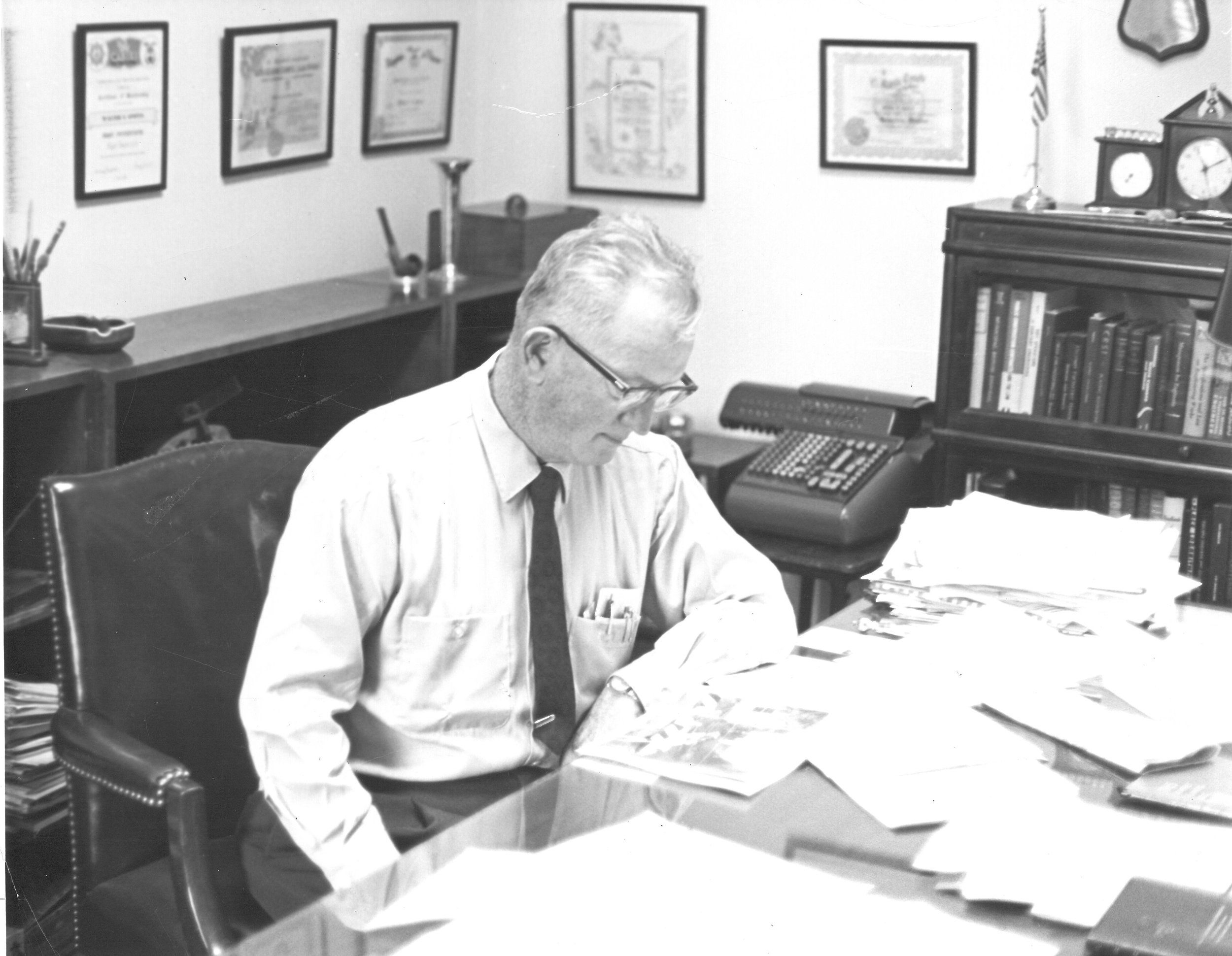
center: Walter Spotts
In 1932, engineering and surveying was a manual process. It started with paper and pencil, capturing data and measurements in the field and then drawing out plans and designs by hand.
Wally Spotts and his team of surveyors conducted field surveys with such tools as a compass, transit, theodolite, steel tape, level and rod. When they returned to the office, the hand-drafting began. Over the past 85 years, there have been a lot of changes in the industry. It’s no longer a manual process.
The introduction of computer-aided drafting (CAD) in the 1980’s significantly changed the way that surveyors and engineers interacted with data. The introduction of GPS allowed our surveyors to use satellites for improved accuracy across miles of terrain; and Robotic Total Stations measure distance and angles via a remote control, allowing us reduce the size of survey crews, and subsequently capture more data points per day.
In the 2000’s the development of laser scanning technology provided quick data capture opportunities for areas that were difficult to reach. SSM purchased their first high-definition scanner in 2007. Coined Lucille by the staff, the high-definition laser scanning technology provided a non-intrusive method to obtain three-dimensional geometry measurements and models of existing structures and sites for both large and small-scale projects. Our recent addition of P40 Leica scanner captures 1,000,000 data points in a second.
We use Drone Flight Services and High-Definition Laser Scanners to obtain 3-D models and measurements of existing structures and sites. This non-intrusive, cost-effective technology saves time while raising the bar for high-definition precision in large- and small-scale projects such as campus master planning, historic building preservation and industrial development or impact sensitive agricultural and preserved lands.
Our surveying and mapping services have always integrated innovative technology. Data points from conventional Total Stations, data collection systems, robotics, high-definition scanning, drone services, and other state-of-the-art equipment are transferred electronically to our CAD system for engineering design. With equipment becoming more sophisticated, the entire process from start to finish has gotten faster and more data intense. More data points can be captured with more accuracy than ever before.
Yes, slide rules, T-squares, triangles, and compasses have been replaced with 3D software, scanners, and drones but nothing will replace our Knowledge, Experience and First class survey staff.


Engineers are plotters of direction and measurements
In 1952, when the private engineering practice of Walter E. Spotts, RS, PE was just 20 years old, clients were treated to a 14 inch by 18 inch hand drawn copy of Homer’s Four Wind Rose.

In 1952, when the private engineering practice of Walter E. Spotts, RS, PE was just 20 years old, clients were treated to a 14 inch by 18 inch hand drawn copy of Homer’s Four Wind Rose.
Mr. Spotts hand lettered the drawing which shows the evolution of what had become the face of the mariner’s compass from the ninth century B.C. beginnings. Direction was determined by the place from which prevailing winds blew. There were four winds in Homer’s world. Boreas, the north wind, blew from Thrace, a wind that rolled up mighty waves. Norus, the south wind, was a stormy petrel bringing sudden squalls, hence dangerous to navigators. Zephryus, the west wind was often represented as a stormy wind but not by Homer who knew the west, where the climate was temperate and the people prosperous. Eurus, the east wind, was seldom mentioned. The wind rose of Homer evolved through the centuries and civilizations to the seventeenth century, 32 point compass face familiar in form, if not by names, to modern navigators. Mr. Spotts, captured that evolution and beauty in his reproduction.
“Engineers are plotters of direction and measurements – on land, sea, in the air and of all physical things. And in a sense, navigators to set a course to solve earthly problems. We are concerned with the direction from which the wind blows and advise our clients so that they might avoid the dangers of unexpected storms. That is on what Spotts, Stevens and McCoy, Inc. based its early traces and which it firmly stands today. To know the direction and measure of elements and to plot a safe course to success is the job of the navigator.”
- Walter Spotts

Engineering Solutions Since 1932
Reflecting on our History . . . from 1932 when it all began to 2017 as we reach new heights . . .
Walter E. Spotts

Lewis J. McCoy, PE

Lou McCoy and Charlie Stevens

Spotts, Stevens and McCoy
Walter E. Spotts, a native of Berks County, started his own professional practice in 1932, which ultimately became Spotts Engineering Associates, Inc.
In 1967 Lewis J. McCoy, PE opened an individual engineering practice in Wyomissing, PA. Mr. McCoy opened his office after 10 years of experience in sanitary engineering with the Pennsylvania Department of Health and a large consulting firm.
In 1968, Charles H. Stevens, PE, CIH, left industry to become a partner in the firm.
As the story goes . . . it was a simple flip of the coin that determined the order of the firms’ name and the business was incorporated in 1969 as Stevens and McCoy, Inc., With expanded industrial engineering services, the firm grew very strongly, serving the needs of local government and industry.
Stevens and McCoy, Inc. acquired Spotts Engineering Associates, Inc., engineers and surveyors, in 1970 and the firm of Spotts, Stevens and McCoy, Inc. was born.
The new company combined Stevens and McCoy, Inc. and the nearly 40 years of experience of Walter Spotts and his staff of 30. It’s because of this Spotts legacy, that Spotts, Stevens and McCoy, Inc. can trace its roots to 1932.
The reputation of the firm expanded and new services and locations were added. Over the years the firm acquired firms in strategic geographic areas, including the Lehigh Valley Office that was opened in 1974. Today, Spotts, Stevens and McCoy continues to be a family-owned regional engineering, environmental, and surveying firm serving local and global clients. We engineer solutions for a better world. Our work touches everyday life; from the water you drink, to the air you breathe, to the buildings and communities where you live, work and play.