Lead and Copper Rule Revisions: GIS for Service Line Inventory
/Understanding the Lead and Copper Rule Revisions
In 2021, the U.S. Environmental Protection Agency (EPA) issued revisions to the Lead and Copper Rule that was first enacted in 1991. The new revisions intend to better protect children and communities from the risks of lead exposure in water. The revisions focus on taking more robust steps to get lead out of drinking water, as well as better informing communities and protecting children at schools and childcare facilities.
Required lead testing in schools and childcare facilities
Establishment of a “trigger level” to enable earlier mitigation
Use of science-based testing protocols to identify more sources of lead
Driving more full replacements of lead service lines
Development and maintenance of a public inventory of water service lines
The revisions to the Lead and Copper rule establish one of the largest updates to water regulation in 30 years. The rule is also accompanied by significant federal dollars available to assist community water systems (CWSs) with their plans for ridding the risk of lead in drinking water. The regulatory compliance deadline for water systems to meet the rule revisions is October of 2024.
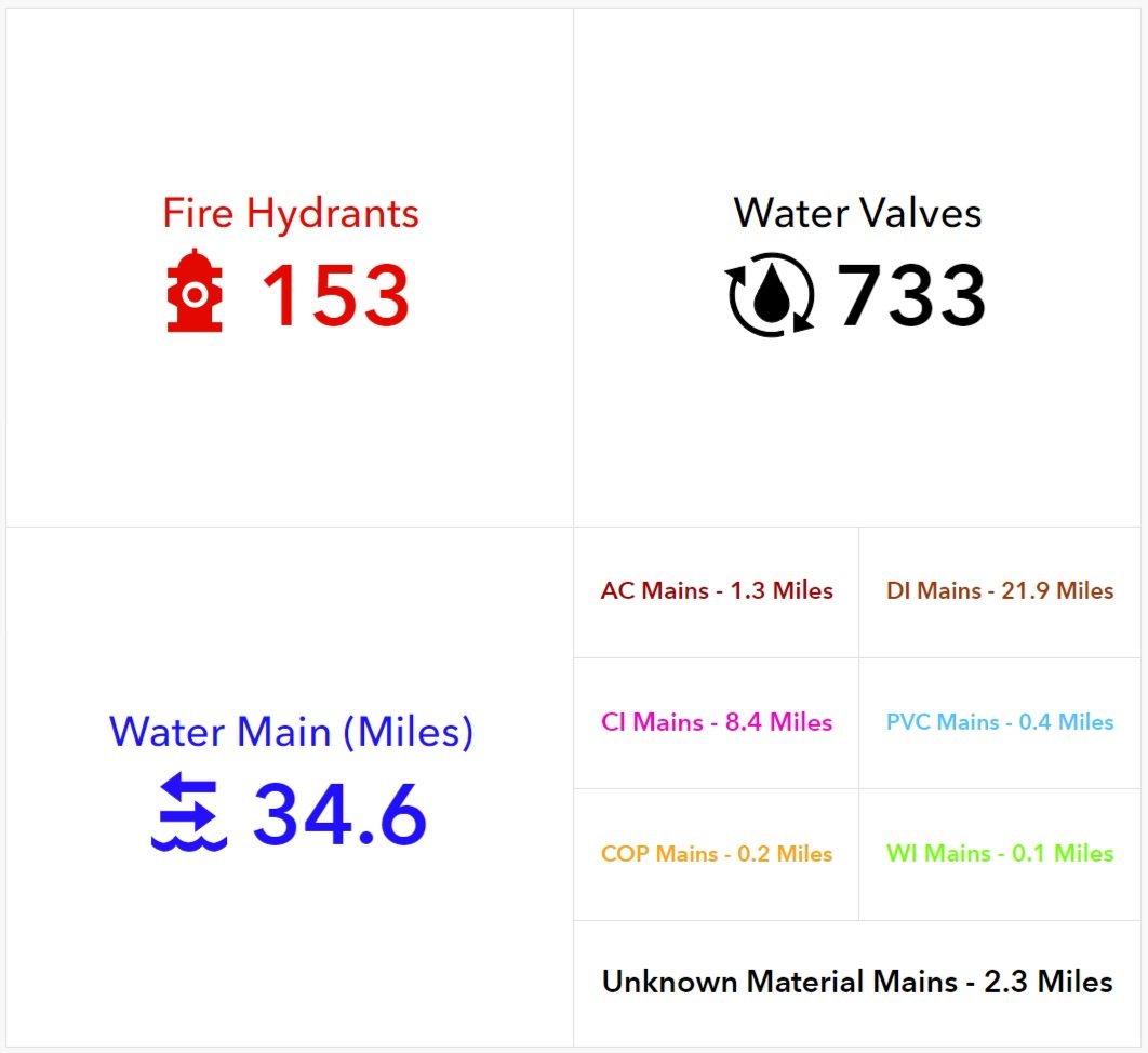
Sample of GIS data dashboard
Managing the Public Service Line Inventory with GIS
Among the revisions, EPA is requiring every water system provider to complete an inventory of their water service lines and report it. If done appropriately, this resource could aid in long-term planning and compliance including laying the groundwork for service line replacement plans as well as managing and tracking improvements and testing records.
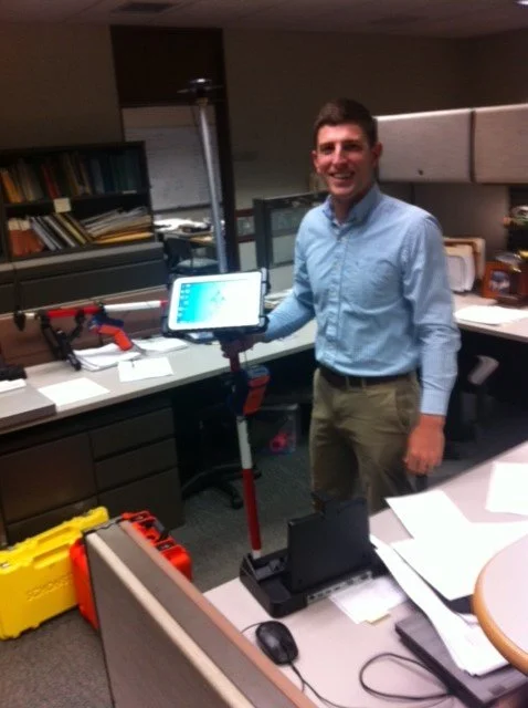
A GIS dashboard, built around your water system means your data is always up to date and always accessible. In lieu of paper collection, management of assets can now be done through smart devices, in the field, with next to real-time updates. And accessing that information is easier than ever before. Your data can be built exactly the way that you need it - accompanying the location, analyzed alongside your capital planning, or summative looking at the whole picture.
Whether you're building your inventory from scratch or modifying your existing database - having a GIS team on board means that you data will start to work for you.
Our GIS team is well-versed in aiding our clients with the collection, documentation, and delivery of both private and public-facing dashboards as well as data analysis that ensures your data turns into an interactive, visual asset. This means all of that information becomes meaningful - saving you time and resources. The goal is not just to build a compliant service line industry. It’s to build one that is also valuable to you. To build an inventory that provides direction, meaning, and protection for you and your community.

The Right Time to Start your Service Line Inventory
The short answer to this common question is: now. While the deadline for compliance with the Lead and Copper Rule revisions isn’t until October 2024, it’s important to get your plan into action as soon as possible. A full inventory collection can be a time intensive process, particularly without deploying modern collection methods. It is recommended that the development of your inventory is as thorough as possible including the required historical records and assessment for replacement. Considering all of this, jumpstarting your inventory collection and database building now is crucial to compliance by 2024.
A great first step is to identify where you currently stand in the road to compliance. Then, assess the opportunities that a GIS team presents for preparing and managing your inventory moving forward.
SSM’s GIS Experience
For more than 20 years, we’ve provided professional GIS services to our clients; from mapping support for infrastructure projects, to focused GIS and data capture projects. We utilize GIS to analyze, visualize, and interpret data to understand patterns, relationships, and trends. Through SSM’s extensive geographic data our clients benefit from faster project startups and the economies of readily available data. SSM’s GIS Asset Management approach helps municipalities to transform water, sewer, storm water, or transportation infrastructure data into an easy-to-use operations asset management system capturing vital infrastructure data points with survey-grade accuracy. The data is verified and compiled into a geo-spatial database. Most of our water/wastewater clients have reaped the benefits of GIS in both their everyday use and long-term planning.
Compliance with Testing Protocols and Service Line Replacement
In addition to our GIS expertise, we have dedicated engineers with water system expertise. Our team of Process and Design Engineers have deep and long-standing experience providing water and wastewater engineering services. A significant number of our staff have more than 20 years of experience serving water and wastewater authorities. We combine professional engineers, professional land surveyors, environmental scientists, designers and drafters into teams to complete each assignment.
When it comes to managing and protecting water resources, SSM is the authority that everyone turns to. SSM offers extraordinary experience in the planning, design, and construction management of wastewater and water systems, piping systems, pumping stations, and treatment plants.
As you continue your planning for compliance with the Lead and Copper Rule Revisions, ensure your engineering team is ready and available to get you there not only with expertise, but with experience.